NASA Name in Landsat: Amazing Journey Behind Earth Observation

Introduction
Have you ever wondered how scientists track deforestation, monitor climate change, or predict natural disasters from space? The answer lies in a remarkable partnership that forever changed how we understand our planet. The NASA name in Landsat represents one of the most successful and enduring space programs in history, spanning over five decades of continuous Earth observation.
Since 1972, the Landsat program has provided an unbroken record of Earth’s surface changes. This collaboration between NASA and the United States Geological Survey (USGS) created the longest continuous dataset of Earth imagery ever collected. Every snapshot tells a story about our changing planet, from shrinking glaciers to expanding cities.
The NASA name in Landsat signifies more than just a satellite program. It represents technological innovation, scientific dedication, and invaluable contributions to environmental understanding. These satellites orbit Earth constantly, capturing detailed images that help researchers, policymakers, and communities make informed decisions about natural resources, urban planning, and disaster response.
This comprehensive article explores the fascinating story behind the NASA name in Landsat. You’ll discover how this program began, evolved through technological advances, and continues shaping our understanding of Earth today. Whether you’re a space enthusiast, environmental advocate, or simply curious about satellite technology, you’ll find valuable insights into one of NASA’s most impactful achievements.
The Birth of the Landsat Program
Understanding the NASA name in Landsat requires traveling back to the late 1960s when Earth observation from space was still revolutionary. The program emerged during an era of rapid technological advancement and growing environmental awareness.
Early Concepts and Vision
NASA scientists envisioned satellites that could systematically photograph Earth’s surface for practical applications. Previous satellites focused primarily on weather monitoring or experimental imaging. The Landsat concept represented something different: continuous, comprehensive Earth observation for resource management and scientific research.
The original name was actually Earth Resources Technology Satellite (ERTS). This designation reflected the program’s primary purpose of monitoring natural resources. Only later did the program adopt the Landsat name, which better captured its mission of observing land surfaces globally.
Stewart Udall, then Secretary of the Interior, championed the program alongside NASA administrators. They recognized that satellite imagery could revolutionize agriculture, forestry, geology, and urban planning. The vision was ambitious: create a permanent record of Earth’s changing landscapes accessible to researchers worldwide.
First Launch and Initial Success
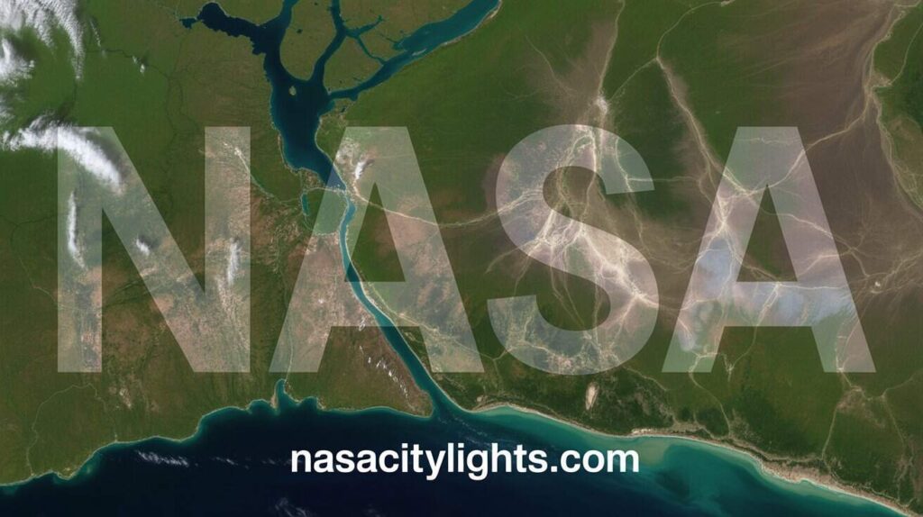
Landsat 1 launched on July 23, 1972, from Vandenberg Air Force Base in California. This pioneering satellite carried two imaging instruments: a Return Beam Vidicon camera system and the Multispectral Scanner System. Together, they captured images in multiple wavelengths, revealing information invisible to human eyes.
The initial images stunned scientists and the public alike. They revealed geological features, vegetation patterns, and land use details with unprecedented clarity. Researchers quickly discovered applications nobody had anticipated, from archaeological site detection to tracking ocean currents through sediment patterns.
The success exceeded expectations dramatically. Within months, the NASA name in Landsat became synonymous with Earth observation excellence. The program demonstrated that satellite imagery could provide practical, actionable information for managing Earth’s resources sustainably.
Establishing the Partnership
NASA handled satellite development, launch, and initial operations. The Department of the Interior, through USGS, managed data reception, processing, and distribution. This partnership model proved remarkably effective, combining NASA’s technological expertise with USGS’s Earth science knowledge.
The collaboration wasn’t always smooth. Different organizational cultures and priorities sometimes created tensions. However, both agencies recognized the program’s importance and worked through challenges. The partnership model established with Landsat influenced many subsequent Earth observation programs.
International cooperation emerged early too. Ground stations worldwide received Landsat data, creating a global network of Earth observation. The NASA name in Landsat helped legitimize remote sensing as a scientific discipline and encouraged other nations to develop similar capabilities.

Technological Evolution Through Landsat Generations
The NASA name in Landsat encompasses nine satellite generations, each representing significant technological advancement. These improvements enhanced image quality, coverage, and data utility continuously.
Landsat 1 Through 3: The Pioneers
The first three Landsat satellites operated from 1972 through 1983. They established baseline capabilities and proved the concept’s viability. Their Multispectral Scanner System captured images in four spectral bands with 80-meter resolution.
These early satellites circled Earth in sun-synchronous orbits, passing over the same locations at consistent times. This orbital design ensured comparable lighting conditions across images, crucial for detecting changes over time. The 16-day repeat cycle became a Landsat standard.
Image quality by modern standards seems crude. However, for their era, these satellites provided revolutionary capabilities. Researchers discovered they could distinguish crop types, identify mineral deposits, and map wetlands accurately. The applications expanded far beyond original expectations.
Landsat 4 and 5: Enhanced Capabilities
Landsat 4, launched in 1982, introduced the Thematic Mapper instrument. This sensor dramatically improved spatial resolution to 30 meters and added thermal infrared capability. The enhanced detail revealed landscape features previously invisible in satellite imagery.
Landsat 5 became legendary for longevity. Designed for a three-year mission, it operated for 29 years until 2013. This remarkable endurance made the NASA name in Landsat synonymous with reliability and value. The satellite collected over 2.5 million images during its extended mission.
The thermal band proved especially valuable for water resource management and volcanic monitoring. Scientists could measure surface temperatures, identify water stress in crops, and detect active lava flows. These capabilities expanded Landsat’s applications significantly.
Landsat 6 and 7: Setbacks and Resilience
Landsat 6 failed to reach orbit in 1993, a painful setback for the program. The loss created a potential data gap that threatened the continuous Earth observation record. However, Landsat 5’s unexpected longevity helped bridge this gap.
Landsat 7 launched in 1999 with the Enhanced Thematic Mapper Plus instrument. It provided even better image quality and added a panchromatic band with 15-meter resolution. The satellite performed excellently until 2003 when a scan line corrector failed.
Despite this mechanical issue, Landsat 7 continues operating today. Scientists developed techniques to compensate for the scan line corrector failure, allowing continued data collection. This adaptability demonstrates the resilience built into the NASA name in Landsat program.
Landsat 8 and 9: Modern Capabilities
Landsat 8, launched in 2013, represents a quantum leap in technology. The Operational Land Imager and Thermal Infrared Sensor provide superior radiometric resolution. Images contain 12-bit data compared to 8-bit from previous satellites, capturing subtle variations in land surface conditions.
The satellite captures the entire Earth every 16 days, maintaining the traditional Landsat cycle. However, improved onboard storage and downlink capabilities enable more comprehensive data collection. Scientists can now study phenomena requiring frequent observations more effectively.
Landsat 9 joined its predecessor in 2021, ensuring data continuity and increasing revisit frequency. Together, these satellites image Earth every eight days, doubling observation opportunities. The NASA name in Landsat continues evolving while maintaining the program’s fundamental mission.
Scientific Applications and Impact
The NASA name in Landsat enabled countless scientific discoveries and practical applications. The program’s impact extends far beyond what its founders envisioned.
Agriculture and Food Security
Farmers and agricultural researchers use Landsat data to monitor crop health, estimate yields, and manage irrigation. The satellites’ multispectral sensors detect vegetation stress before it becomes visible to human observers. This early warning capability helps optimize water use and prevent crop losses.
Global food security assessments rely heavily on Landsat imagery. International organizations track agricultural production worldwide, identifying regions at risk of food shortages. This information supports humanitarian aid planning and food distribution efforts.
Precision agriculture applications use Landsat data to guide variable rate fertilizer and pesticide applications. By identifying areas within fields requiring different treatment levels, farmers reduce chemical use while maintaining productivity. This environmentally friendly approach saves money and protects ecosystems.
Forest Monitoring and Conservation
Landsat provides the most comprehensive record of global deforestation and forest degradation. Researchers track forest loss across entire countries, identify illegal logging operations, and monitor reforestation efforts. This capability proves crucial for climate change research and biodiversity conservation.
The Amazon rainforest monitoring system relies extensively on Landsat imagery. Scientists detect forest clearing almost in real time, enabling rapid response to illegal deforestation. Similar systems operate in Indonesia, Central Africa, and other forested regions worldwide.
Forest fire monitoring represents another critical application. Landsat’s thermal sensors detect active fires while other bands map burn scars and vegetation recovery. This information helps fire managers allocate resources and assess ecological impacts.
Water Resource Management
Water managers use Landsat to map water bodies, monitor reservoir levels, and track irrigation patterns. In water-scarce regions, this information becomes critical for allocating limited supplies among competing uses. The satellites reveal water consumption patterns that ground-based monitoring misses.
Glacier and snow cover monitoring helps predict water availability in regions depending on snowmelt. Researchers document glacier retreat worldwide, providing essential data for climate change studies. The NASA name in Landsat is associated with definitive records of these changes.
Wetland mapping and monitoring protect these ecologically vital ecosystems. Landsat imagery distinguishes wetland types and tracks drainage or restoration activities. This capability supports regulatory enforcement and conservation planning.
Urban Planning and Development
City planners use Landsat imagery to track urban expansion, identify heat islands, and monitor green space changes. The 30-meter resolution provides appropriate detail for metropolitan-scale analysis while covering large areas efficiently.
The complete Landsat archive enables researchers to study urbanization patterns over decades. They can measure how cities grow, identify sprawl patterns, and assess infrastructure development. This historical perspective informs sustainable urban planning decisions.
Land use and land cover mapping depends heavily on Landsat data. These maps support zoning decisions, transportation planning, and environmental impact assessments. The consistent, unbiased nature of satellite observations provides valuable planning information.
Disaster Response and Management
Emergency managers use Landsat imagery to assess damage from floods, earthquakes, wildfires, and volcanic eruptions. The satellites provide rapid, comprehensive views of affected areas, supporting response coordination and recovery planning.
The thermal infrared capability helps monitor volcanic activity and detect potential eruptions. Scientists track temperature changes in volcanic craters and lava domes, providing early warning signs. This monitoring saves lives in vulnerable communities.
Flood mapping uses Landsat’s ability to distinguish water from land reliably. Emergency responders identify inundated areas, plan evacuation routes, and assess infrastructure damage. The free, publicly available data ensures rapid access during crises.
The NASA and USGS Partnership
The NASA name in Landsat reflects a unique governmental partnership that has endured for over five decades. Understanding this collaboration reveals why the program succeeded when similar efforts struggled.
Complementary Strengths
NASA brings unparalleled expertise in satellite design, launch operations, and space technology. Their engineers develop cutting-edge sensors and spacecraft platforms. This technical excellence ensures each Landsat generation advances beyond its predecessor.
USGS contributes deep knowledge of Earth science, data management, and user needs. They understand what researchers require from satellite imagery and how to make data accessible. This user-focused approach ensures Landsat data serves practical applications effectively.
The partnership divides responsibilities clearly. NASA handles satellite development and initial checkout. USGS manages ongoing operations, data processing, and distribution. This division allows each agency to focus on its strengths while supporting common goals.
Data Policy and Access
The decision to provide free, open access to Landsat data transformed the program’s impact. Before 2008, users paid for imagery, limiting who could access this valuable resource. Opening the archive democratized Earth observation globally.
Download statistics exploded after the policy change. Millions of images are distributed annually to users worldwide. Researchers in developing countries gained access to data previously too expensive. This accessibility multiplied the NASA name in Landsat‘s scientific and social value.
The open data policy influenced other space agencies to adopt similar approaches. The European Space Agency’s Copernicus program and other initiatives followed Landsat’s example. This trend toward open Earth observation data benefits humanity enormously.
Ensuring Program Continuity
Maintaining the Landsat program requires sustained political and financial support. Budget constraints periodically threatened continuity. However, the strong partnership helped navigate funding challenges and maintain the observation record.
Both agencies advocate for the program with different audiences. NASA emphasizes technological achievement and space exploration connections. USGS highlights practical applications and economic benefits. This two-pronged advocacy approach strengthens political support.
Planning future Landsat missions begins years before launches. Landsat Next, currently in development, will provide even more advanced capabilities. The partnership ensures long-term vision guides program evolution, preventing gaps in Earth observation coverage.
Global Impact and International Cooperation
The NASA name in Landsat resonates globally, influencing international Earth observation efforts and fostering scientific collaboration across borders.
International Ground Stations
Countries worldwide operate ground stations receiving Landsat data directly. These facilities enable regional data access without depending entirely on U.S. infrastructure. The network includes stations in Australia, Europe, South America, and Asia.
International cooperation agreements govern ground station operations. Partner nations receive data for their regions while contributing to global coverage. This distributed approach increases data availability and resilience against single-point failures.
Some nations use Landsat data to develop their own remote sensing capabilities. The program serves as a model and training ground for emerging space agencies. This capacity building spreads Earth observation benefits globally.
Supporting Sustainable Development
The United Nations Sustainable Development Goals rely partly on Landsat data for monitoring progress. Indicators related to water quality, forest cover, urban growth, and agricultural productivity use satellite imagery extensively.
Developing nations particularly benefit from free Landsat access. Countries lacking resources for satellite programs still obtain essential Earth observation data. This equity supports global development and environmental protection efforts.
International research collaborations produce countless studies using Landsat imagery. Scientists from different countries combine satellite data with local knowledge, creating insights neither could achieve alone. The NASA name in Landsat facilitates this productive global cooperation.
Influencing Other Programs
Landsat established many standards that subsequent Earth observation programs adopted. The 16-day repeat cycle, multispectral imaging approach, and open data policies influenced programs worldwide. Sentinel-2, for example, complements Landsat with compatible but more frequent observations.
The program demonstrated that civilian Earth observation satellites provide immense value. This proof concept encouraged investments in similar capabilities globally. Today’s constellation of Earth observation satellites owes much to Landsat’s pioneering success.
Commercial satellite companies increasingly offer Landsat-like capabilities. While they often charge for data, their existence validates the market Landsat helped create. The NASA name in Landsat effectively launched an entire industry.
Challenges and Future Directions
Despite remarkable success, the Landsat program faces ongoing challenges and must continue evolving to meet emerging needs.
Maintaining Data Continuity
Ensuring uninterrupted data collection requires carefully timed satellite launches. Gaps in coverage would break the precious continuous record spanning over 50 years. Budget uncertainties and technical delays create risks that program managers must navigate carefully.
Landsat satellites have finite lifespans despite remarkable longevity. Planning must account for potential early failures while avoiding expensive satellite overlaps. This balancing act requires sophisticated risk management and flexible operational strategies.
The NASA name in Landsat depends partly on maintaining this unbroken record. Any significant gap would diminish the program’s unique value. Both NASA and USGS prioritize continuity in their planning and advocacy efforts.
Technological Advancement
User needs evolve as technology and applications advance. Higher spatial resolution, more frequent observations, and additional spectral bands all attract demand. Balancing improvements against cost and complexity challenges program planners.
Landsat Next aims to address these demands with six satellites providing enhanced capabilities. More frequent revisits will support applications requiring near-daily observations. Additional spectral bands will enable new applications while maintaining continuity with historical data.
Artificial intelligence and machine learning create new possibilities for Landsat data analysis. These tools can process the massive archive faster than humans, revealing patterns and changes automatically. Integrating these technologies maximizes the value of Landsat observations.
Complementing Commercial Options
Commercial satellite companies now offer very high-resolution imagery and daily revisit capabilities. Some question whether government programs like Landsat remain necessary. However, Landsat provides unique value that commercial options don’t replicate.
The free, open data policy ensures universal access regardless of ability to pay. The calibration quality and consistency enable scientific studies requiring reliable measurements over decades. No commercial provider matches Landsat’s 50-year archive or commitment to long-term continuity.
Rather than competing, Landsat and commercial satellites serve complementary roles. Researchers often combine both data types, using Landsat for consistent long-term analysis and commercial imagery for detailed snapshots. The NASA name in Landsat represents a public good that market forces alone wouldn’t provide.
Climate Change Monitoring
Climate change increases the urgency for comprehensive Earth observation. Landsat data documents countless climate impacts from glacier retreat to vegetation shifts to sea level rise. These records become more valuable as climate change accelerates.
Future Landsat missions will likely emphasize climate-relevant measurements even more strongly. Enhanced thermal capabilities could improve drought monitoring and heat stress detection. Additional spectral bands might better track vegetation responses to changing conditions.
The program’s historical archive proves invaluable for climate research. Scientists compare current conditions to decades past, quantifying changes and identifying trends. No other dataset provides comparable spatial detail and temporal depth for land surface analysis.
Economic and Social Value
The NASA name in Landsat represents extraordinary return on investment for American taxpayers and global benefits extending far beyond monetary measures.
Economic Benefits
Studies estimate that Landsat generates billions of dollars in economic value annually. Agricultural applications alone save farmers substantial amounts through improved efficiency. Water resource management prevents losses worth millions in drought-prone regions.
The program’s total cost over 50 years remains modest compared to benefits delivered. Free data access multiplies value by enabling countless users to generate applications and insights. This multiplier effect makes Landsat one of the most cost-effective government programs.
Commercial industries built on Landsat data employ thousands of people globally. Geographic information systems, precision agriculture services, and environmental consulting firms all depend on satellite imagery. The NASA name in Landsat essentially seeded entire economic sectors.
Educational Impact
Landsat imagery enriches education from elementary schools to universities. Students explore their communities from space, study environmental changes, and learn remote sensing principles. The accessible data democratizes space science education.
Universities worldwide teach courses using Landsat imagery and analysis tools. Entire academic disciplines like landscape ecology and land change science depend heavily on satellite observations. The program trains each new generation of Earth scientists.
Public engagement with Landsat imagery fosters environmental awareness and scientific literacy. People can explore Earth’s changes firsthand rather than relying solely on secondhand descriptions. This direct engagement makes environmental issues more tangible and relatable.
Social Equity and Justice
Free Landsat access promotes social equity by providing valuable information to disadvantaged communities. Indigenous groups use imagery to document land rights and monitor territories. Environmental justice advocates identify pollution patterns and hold polluters accountable.
Developing nations benefit disproportionately from open data policies. Countries unable to afford satellite programs still obtain crucial Earth observation capabilities. This levels the playing field internationally and supports global development.
The NASA name in Landsat represents democratic ideals applied to space technology. Rather than hoarding valuable data, the U.S. shares it freely with humanity. This generosity builds goodwill and demonstrates how space exploration can benefit everyone.

Conclusion
The NASA name in Landsat represents more than a satellite program. It embodies a vision of using space technology to understand and protect our planet. For over five decades, this remarkable partnership between NASA and USGS has delivered an unparalleled record of Earth’s changing surface.
From humble beginnings with grainy 80-meter images, Landsat evolved into a sophisticated Earth observation system providing detailed, multispectral data freely to anyone worldwide. The program revolutionized agriculture, forestry, water management, urban planning, and disaster response. Its contributions to climate science alone justify the investment many times over.
The partnership model combining NASA’s technical excellence with USGS’s Earth science expertise proved remarkably successful. Their commitment to open data access multiplied the program’s impact exponentially. Today, millions of people benefit from Landsat imagery, often without realizing it.
As Landsat Next takes shape, the program’s future looks bright. New technologies will enhance capabilities while maintaining the precious continuity that makes Landsat unique. The unbroken observation record spanning over half a century represents an irreplaceable scientific treasure.
The NASA name in Landsat symbolizes what humanity can achieve when we combine technological innovation with scientific dedication and democratic values. It shows that space exploration isn’t just about distant planets but also about understanding and caring for our own. What will the next 50 years of Landsat reveal about our changing planet, and how will we use that knowledge to build a more sustainable future?
Frequently Asked Questions
What does NASA’s role in Landsat involve?
NASA handles Landsat satellite design, development, launch operations, and initial on-orbit checkout. The agency applies its space technology expertise to create increasingly advanced instruments and spacecraft platforms. Once satellites are operational, USGS assumes responsibility for ongoing operations, data processing, and distribution to users worldwide.
How many Landsat satellites has NASA launched?
NASA has launched nine Landsat satellites since 1972, though Landsat 6 failed to reach orbit. Currently, Landsat 8 and Landsat 9 operate simultaneously, providing comprehensive Earth coverage every eight days. Previous Landsat satellites exceeded their design lifespans significantly, with Landsat 5 operating for 29 years despite a planned three-year mission.
Is Landsat data really free to access?
Yes, all Landsat data is completely free and openly available to anyone worldwide. Since 2008, USGS has provided unrestricted access to the entire archive containing millions of images. You can download imagery through the USGS Earth Explorer website without fees, registration requirements, or restrictions on use.
What makes Landsat different from other Earth observation satellites?
Landsat’s unique value lies in its 50-plus year continuous observation record, moderate 30-meter spatial resolution ideal for many applications, consistent calibration enabling reliable change detection, and free open data policy. No other program combines these characteristics, making Landsat irreplaceable for long-term Earth surface monitoring and scientific research.
How often does Landsat image the same location?
Each individual Landsat satellite images every location on Earth every 16 days. With both Landsat 8 and 9 operating, the combined revisit frequency is eight days. However, cloud cover often obscures the surface, so usable images for specific locations may be less frequent depending on local weather patterns.
What can Landsat images detect that human eyes cannot?
Landsat sensors capture wavelengths beyond human vision, including near-infrared and thermal infrared. These bands reveal vegetation health, water content, surface temperatures, and mineral compositions invisible to human observers. Multispectral analysis combines different wavelengths to identify materials and conditions that look identical in visible light.
How does NASA ensure Landsat data quality?
NASA designs sophisticated calibration systems into each satellite, allowing precise measurement of reflected and emitted radiation. Ground teams regularly validate measurements against known targets. The instruments undergo extensive pre-launch testing and continuous on-orbit monitoring. This rigorous quality control ensures Landsat data meets scientific standards for accuracy and reliability.
Who uses Landsat data?
Landsat users include agricultural researchers, forest managers, water resource planners, urban developers, climate scientists, disaster responders, government agencies, commercial companies, educators, and students. The free access policy means anyone from individual citizens to international organizations can utilize the imagery for countless applications benefiting society and environment.
Will there be future Landsat satellites after Landsat 9?
Yes, NASA and USGS are developing Landsat Next, planned to launch around 2030. This mission will consist of multiple satellites with enhanced capabilities including more frequent observations, additional spectral bands, and improved spatial resolution. The agencies remain committed to maintaining the continuous Landsat observation record indefinitely.
How has Landsat contributed to climate change research?
Landsat provides definitive records of climate change impacts including glacier retreat, vegetation shifts, sea ice changes, and land use transformations. The 50-year archive enables scientists to quantify changes precisely and identify trends. This long-term, consistent dataset proves invaluable for understanding climate dynamics and validating climate models.
Read More…
Author Bio
A space technology writer and Earth science enthusiast with deep expertise in satellite remote sensing programs and their applications. Passionate about making complex space missions and scientific concepts accessible to general audiences while maintaining technical accuracy. Dedicated to highlighting how space technology improves life on Earth and advances environmental understanding.