
What Is NASA Black Marble? Amazing Yet Overlooked Data in 2026
Introduction
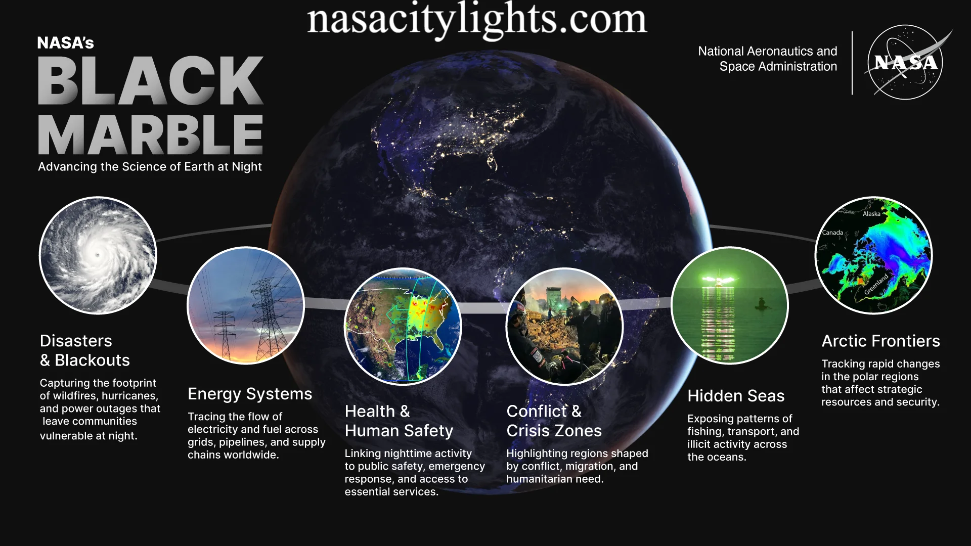
Have you ever looked at a nighttime photo of Earth from space and wondered how those glowing city lights get captured so clearly? That image likely came from NASA Black Marble. So what is NASA Black Marble exactly? It is a global nighttime satellite imagery program that shows how Earth looks after the sun goes down. It tracks everything from bright city centers to dark blackout zones after a hurricane.
You have probably seen these glowing maps shared online during major news events. They look stunning, but they also serve a serious purpose. Scientists, emergency teams, and city planners rely on this data every single day. In this article, we will explain what NASA Black Marble is, how it works, who uses it, and why it matters to you, even if you have never heard of it before today.
What Is NASA Black Marble?
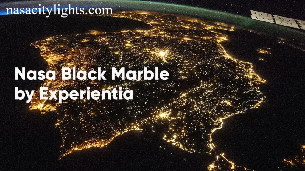
NASA Black Marble is a collection of nighttime satellite images and data products that map artificial light across the entire planet. Instead of showing sunlight reflecting off land and oceans like typical daytime images, it captures the glow of streetlights, buildings, wildfires, and other light sources at night.
If you are still asking yourself what is NASA Black Marble in simple terms, think of it as a giant nightlight map of Earth. It shows where people live, where power is flowing, and where darkness suddenly appears when something goes wrong.
This program is run by NASA in partnership with other United States agencies. It turns raw satellite readings into usable maps and datasets that anyone can access.
Why Is It Called Black Marble?
You might recall NASA’s famous Blue Marble photo, the iconic daytime image of Earth taken decades ago. Black Marble is its nighttime twin. While Blue Marble shows the planet bathed in sunlight, Black Marble shows the same planet glowing softly against a dark background.
The name captures that contrast perfectly. One is bright and blue. The other is dark and dotted with light. Together they give us a full picture of Earth, day and night.
Which Satellite Collects Black Marble Data?
The data mainly comes from an instrument called the Visible Infrared Imaging Radiometer Suite, often shortened to VIIRS. This sensor sits aboard two satellites, Suomi NPP and NOAA 20.
These satellites orbit Earth and pass over the same regions at roughly the same local time each night. This consistency helps scientists compare images from different dates and spot changes accurately.
How Does NASA Black Marble Work?
Understanding what is NASA Black Marble also means understanding how it actually functions. VIIRS is incredibly sensitive. It can detect very faint amounts of visible and near infrared light coming from Earth’s surface, even light as dim as a single streetlamp in a rural town.
Here is the tricky part though. The moon, clouds, and other atmospheric conditions can interfere with these readings. NASA solves this by applying advanced correction algorithms. These filters remove moonlight glow, cloud cover, and seasonal vegetation changes so what remains is a clean, accurate view of human made light.
I find this part fascinating because it shows how much processing happens behind a single image. It is not just a photo. It is a carefully calibrated dataset built from multiple layers of correction.
What Is NASA Black Marble Used For?
Now that you know what NASA Black Marble is, let’s talk about why it matters. This tool goes far beyond pretty pictures. Governments, researchers, and businesses use it for real world decisions every day.
Monitoring City Lights
Urban areas naturally shine brighter than rural ones. By comparing light patterns over time, researchers can watch cities expand, shrink, or shift their energy use patterns.
Tracking Power Outages
This is one of the most talked about uses. When a major storm knocks out electricity, Black Marble images show exactly where the lights went dark. Emergency teams use this information to prioritize repairs and send help to the hardest hit areas first.
Measuring Urban Growth
Cities grow fast, and official records do not always keep up. Nighttime light data offers a quick way to estimate population growth and new development, especially in regions where traditional data collection is limited.
Studying Disasters and Recovery
After hurricanes, wildfires, or earthquakes, Black Marble helps track how quickly a region bounces back. If an area stays dark for weeks, that signals ongoing infrastructure damage. If lights slowly return, that shows recovery in progress.
Analyzing Human Activity and Economic Trends
Believe it or not, nighttime light levels often correlate with economic activity. Brighter areas usually mean more commercial activity, more electricity use, and sometimes stronger local economies.
Real World Applications Across the United States and Beyond
Black Marble is not just a research tool sitting in a lab. It gets used in real situations across the country and around the world.
- During major hurricanes along the Gulf Coast, teams have used nighttime imagery to map power restoration progress across affected states.
- Wildfire response teams in California and other western states use this data to see how far fire damage spreads and how utility outages follow.
- Earthquake response teams overseas have used similar imagery to identify which neighborhoods lost power completely after a disaster struck.
- City planners in growing metro areas study long term light trends to guide infrastructure and energy planning decisions.
These examples show why understanding what is NASA Black Marble matters beyond just science class curiosity. It plays a real role in keeping communities safer and better informed.
Black Marble vs Blue Marble
People often confuse these two, so let’s clear it up quickly.
| Feature | Blue Marble | Black Marble |
|---|---|---|
| Time of day | Daytime | Nighttime |
| Main focus | Land, oceans, clouds | Artificial lights |
| Common use | Geography education, weather | Disaster response, urban studies |
| Visual style | Bright, colorful Earth | Dark background with glowing points |
Both are valuable, but they answer different questions. Blue Marble tells you what the land and atmosphere look like. Black Marble tells you where human activity and energy use are happening after dark.
Is NASA Black Marble Free?
Yes, and this surprises a lot of people. NASA makes Black Marble data completely free to access for researchers, students, governments, and curious individuals like you. There is no subscription fee or paywall involved.
This open access approach means small nonprofits and large government agencies can use the exact same high quality data. That level of accessibility is rare and genuinely impressive.
How Often Is Black Marble Updated?
Data products come in different time frames depending on your needs.
- Daily products show nightly snapshots, useful for tracking fast moving events like storms.
- Monthly products smooth out short term noise and show general trends.
- Annual products help researchers study long term change over years.
This flexibility lets users pick the right level of detail for their specific project, whether that is emergency response or long term climate research.
Why This Matters for Climate and Environmental Research
Nighttime light data also plays a growing role in climate science. Researchers use it to study light pollution, track energy consumption patterns, and even estimate greenhouse gas emissions in certain regions. As cities continue to grow, this kind of data becomes increasingly valuable for understanding humanity’s environmental footprint.
Final Thoughts
So, what is NASA Black Marble in the end? It is far more than a beautiful nighttime photo of Earth. It is a powerful, freely available dataset that helps track disasters, monitor power outages, study urban growth, and understand human activity across the globe.
Next time you see a glowing nighttime map of a city or region after a major storm, you will know exactly where that image came from and why it matters. Do you think tools like this should be used more often in disaster planning? Feel free to share this article with someone who would find it just as fascinating as you did.
FAQs
What is NASA Black Marble in simple words? It is a nighttime satellite imagery program that maps artificial light across Earth, showing cities, power outages, and human activity after dark.
What satellite provides Black Marble imagery? The VIIRS instrument aboard the Suomi NPP and NOAA 20 satellites collects the data.
Is NASA Black Marble available to the public for free? Yes, anyone can access the data at no cost, including students, researchers, and everyday curious users.
How is Black Marble different from Blue Marble? Blue Marble shows Earth during the day using sunlight, while Black Marble shows Earth at night using artificial light sources.
Can Black Marble track power outages after a storm? Yes, it is commonly used to identify blackout zones and monitor how quickly power gets restored.
How often does NASA update Black Marble data? Data is available daily, monthly, and annually depending on the type of analysis needed.
Does moonlight affect Black Marble images? NASA applies correction algorithms to remove moonlight, cloud interference, and seasonal effects for cleaner results.
Why do researchers use nighttime light data for economic studies? Brighter areas often correlate with higher commercial activity and electricity use, giving researchers a quick way to estimate economic trends.
nasacitylights.com
Email: johanharwen314@gmail.com
Author Name: Hamid Ali
About the Author: Hamid Ali is a content writer who enjoys breaking down complex science and technology topics into simple, easy to read articles. He focuses on space, environment, and emerging technology stories that help everyday readers understand the world a little better.