Oregon Volcano Eruption: Critical Facts Every Resident Must Know
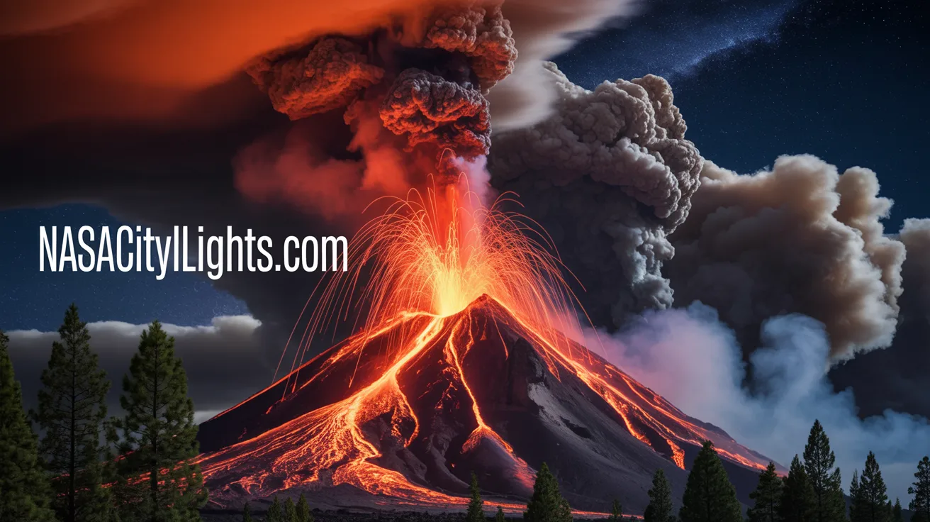
The Pacific Northwest sits on one of the most geologically active zones on Earth. Oregon volcano eruption potential is not a distant Hollywood disaster scenario. It’s a genuine threat that scientists monitor constantly. The Cascade Range running through Oregon contains numerous volcanoes that have erupted in the past and will erupt again in the future.
Mount St. Helens proved this reality in 1980 when it devastated the landscape just across the Columbia River from Oregon. That catastrophic event killed 57 people and caused billions in damage. Oregon’s own volcanic peaks pose similar dangers to communities, infrastructure, and the environment. Understanding these risks helps you prepare for scenarios that could unfold with little warning.
Scientists estimate that several Oregon volcanoes will erupt within your lifetime or your children’s lifetimes. This isn’t fear mongering. It’s geological fact based on eruption histories and ongoing monitoring data. The question isn’t if but when the next significant Oregon volcano eruption will occur.
This comprehensive guide examines Oregon’s volcanic threats in detail. You’ll discover which volcanoes pose the greatest risks, what warning signs to watch for, how eruptions could impact your community, and crucial preparation steps that could save lives. Whether you live near these volcanic peaks or simply want to understand Oregon’s geological reality, this information empowers you to make informed decisions about safety and preparedness.
Oregon’s Most Dangerous Volcanoes
Oregon contains multiple volcanoes capable of significant eruptions. Not all pose equal threats, and understanding the specific dangers of each helps you assess your personal risk level.
Mount Hood: Oregon’s Sleeping Giant
Mount Hood towers over Portland, visible from the city on clear days. This stratovolcano stands 11,249 feet tall and represents Oregon’s most potentially catastrophic volcanic threat. More than half a million people live within the zones that could be impacted by a major Mount Hood eruption.
The mountain last erupted in the 1790s, producing pyroclastic flows and lahars that swept down its flanks. Lahars are devastating mudflows composed of volcanic debris, ice, and water. They can travel at highway speeds and bury everything in their path under meters of concrete-like sediment.
Mount Hood’s proximity to Portland creates unique dangers. The volcano sits only 50 miles from Oregon’s largest metropolitan area. Critical infrastructure including highways, bridges, water supplies, and electrical systems lie within potential impact zones. An eruption could paralyze the region economically even without directly threatening the city itself.
Scientists classify Mount Hood as an active volcano with high eruption potential. Monitoring equipment detects regular small earthquakes beneath the peak. Hot springs and fumaroles indicate that magma exists not far below the surface. All signs point toward Mount Hood eventually awakening from its current dormancy.
Crater Lake and Mount Mazama
Crater Lake fills the collapsed caldera of Mount Mazama, which exploded catastrophically about 7,700 years ago. This eruption ranks among the most powerful in the Cascade Range’s history. It ejected approximately 50 cubic kilometers of material and created ash deposits found across North America.
The Crater Lake area remains volcanically active despite the mountain’s dramatic collapse. Scientists have identified a growing lava dome on the caldera floor beneath the lake’s surface. Hydrothermal vents release heat and chemicals into the lake waters. These signs indicate that magma continues accumulating beneath Crater Lake.
A future eruption at Crater Lake could take various forms. Small eruptions might create new volcanic cones or lava flows. A more catastrophic scenario could breach the caldera rim, draining the lake rapidly and creating devastating floods downstream. The unpredictability makes Crater Lake a significant concern for volcanologists.
The remote location limits immediate human impact compared to Mount Hood. However, the potential for massive eruptions and the popular tourist destination status create planning challenges. Park services and emergency managers must balance accessibility with safety as they monitor this geological wonder.
Three Sisters Volcanic Complex
The Three Sisters consist of North Sister, Middle Sister, and South Sister. These stratovolcanoes in central Oregon rise above the Cascade Range. South Sister last erupted approximately 2,000 years ago, making it one of Oregon’s more recently active volcanoes.
Beginning around 1997, scientists detected ground deformation near South Sister. The area rose several inches, creating a bulge approximately 15 kilometers wide. This uplift indicates magma intrusion beneath the surface. While the swelling has slowed, it demonstrates that the volcanic system remains active.
The Three Sisters area attracts numerous hikers, climbers, and outdoor enthusiasts. Communities like Sisters and Bend lie downstream from potential lahar paths. An eruption could threaten recreational areas, mountain passes, and water supplies. The economic impact on Oregon’s outdoor recreation industry could be substantial.
Continued monitoring shows varying levels of seismic activity and ground deformation. Scientists cannot predict exactly when or if these observations will culminate in an eruption. The uncertainty requires maintaining vigilance and ensuring that emergency response plans remain current and actionable.
Newberry Volcano
Newberry Volcano near Bend represents one of North America’s largest volcanoes by area. This shield volcano covers approximately 1,200 square miles. Its most recent eruption occurred about 1,300 years ago, producing the Big Obsidian Flow visible at Newberry National Volcanic Monument.
The volcano features a large caldera containing Paulina Lake and East Lake. Numerous cinder cones, lava flows, and obsidian deposits across the volcano demonstrate its varied eruption history. Hot springs and geothermal activity indicate that heat sources persist beneath the surface.
Newberry’s proximity to Bend creates planning challenges. The city has experienced rapid growth in recent decades. Many residents may not fully appreciate living near an active volcano. Educational outreach helps communities understand risks and appropriate emergency responses.
Future eruptions at Newberry could range from relatively gentle lava flows to explosive events creating pyroclastic flows and ash clouds. The volcano’s size and complex structure make predicting eruption styles challenging. Comprehensive monitoring provides the best early warning system currently available.

Understanding Volcanic Hazards
Oregon volcano eruption dangers extend beyond simple lava flows. Multiple hazards threaten people, property, and infrastructure both near and far from erupting peaks.
Pyroclastic Flows and Surges
Pyroclastic flows are superheated mixtures of gas, ash, and rock fragments that race down volcanic slopes at speeds exceeding 100 miles per hour. Temperatures can reach 1,500 degrees Fahrenheit. Nothing in their path survives. These flows represent the deadliest volcanic hazard.
Pyroclastic surges are similar but less dense. They can travel farther and surmount obstacles that might deflect denser flows. Both phenomena killed thousands at Mount Vesuvius and Mount Pelee. Oregon volcanoes are capable of generating these deadly currents during explosive eruptions.
The speed and temperature make escape nearly impossible once pyroclastic flows begin. Evacuation must occur before eruptions start. This reality emphasizes the importance of heeding evacuation orders and understanding your location relative to volcanic hazard zones.
Modern monitoring systems aim to provide hours or days of warning before major eruptions. However, volcanoes sometimes behave unpredictably. Maintaining awareness and having evacuation plans ensures you can respond quickly when scientists issue warnings.
Lahars and Mudflows
Lahars pose significant threats even during small eruptions or without eruptions at all. These flows consist of volcanic debris mixed with water from melted snow, ice, or crater lakes. They follow river valleys and can travel over 100 miles from their source.
Mount Hood’s glaciers contain enough ice to generate massive lahars during eruptions. These flows would follow the Sandy, Hood, and White Rivers toward populated areas. The lahars could reach communities within an hour of formation, leaving little time for evacuation.
Lahars have consistency similar to wet concrete. They carry enormous boulders, trees, and debris capable of destroying bridges and buildings. The deposits solidify after stopping, creating landscapes buried under meters of hardened sediment.
Previous Oregon volcano eruptions generated lahars that traveled far beyond the mountains themselves. Geological evidence shows deposits in areas now occupied by homes, farms, and infrastructure. Understanding this history helps identify vulnerable locations requiring special planning and preparation.
Volcanic Ash and Air Quality
Explosive Oregon volcano eruptions can eject ash high into the atmosphere. Prevailing winds typically carry ash eastward, but wind patterns vary. Portland and other western Oregon communities could receive significant ashfall depending on eruption dynamics and weather conditions.
Volcanic ash is not like campfire ash. It consists of tiny glass shards and rock fragments that damage engines, contaminate water supplies, collapse roofs, and cause respiratory problems. Even thin ash layers create hazardous driving conditions and disrupt daily life.
The 1980 Mount St. Helens eruption deposited ash across eastern Washington and beyond. Cities hundreds of miles away dealt with ash cleanup for months. A similar Oregon volcano eruption could paralyze transportation, close airports, and strain emergency services across multiple states.
Preparing for ashfall involves having masks or respirators, protective eyewear, methods to seal buildings, and supplies to shelter in place for extended periods. Communities downwind from volcanoes need specific plans addressing ash cleanup, water treatment, and infrastructure protection.
Lava Flows and Volcanic Gases
Lava flows move slowly enough that they rarely kill people directly. However, they destroy everything in their paths completely. Buildings, forests, and infrastructure cannot survive contact with molten rock reaching temperatures above 1,800 degrees Fahrenheit.
Some Oregon volcanoes are more likely to produce lava flows than explosive eruptions. The specific hazard depends on magma composition and volcanic structure. Basaltic magma creates fluid lava flows, while more viscous rhyolitic magma often leads to explosive eruptions.
Volcanic gases including sulfur dioxide, carbon dioxide, and hydrogen sulfide can poison air quality over large areas. These gases cause acid rain, respiratory problems, and environmental damage. In extreme concentrations, carbon dioxide can accumulate in low areas and cause asphyxiation.
Understanding the specific hazards associated with each Oregon volcano helps tailor emergency plans. Different volcanoes require different responses based on their unique characteristics and eruption histories.
Monitoring and Warning Systems
Scientists monitor Oregon volcanoes continuously using sophisticated equipment and techniques. These systems provide the early warnings necessary for effective emergency response.
Seismic Monitoring Networks
Earthquakes often precede volcanic eruptions as magma moves beneath the surface. Networks of seismometers detect and locate these earthquakes with increasing precision. Unusual earthquake patterns alert scientists to potential volcanic activity.
The USGS Cascades Volcano Observatory operates monitoring equipment on Oregon’s highest-risk volcanoes. This network has expanded significantly since the 1980 Mount St. Helens eruption demonstrated the importance of comprehensive surveillance.
Earthquake swarms, changes in earthquake depths, and harmonic tremors all indicate magma movement. Scientists analyze these patterns to assess eruption likelihood and potential timing. While predictions remain imperfect, monitoring dramatically improves warning capabilities.
You can access real-time earthquake data online through USGS resources. While most earthquakes near volcanoes don’t indicate imminent eruptions, staying informed helps you recognize when patterns become concerning.
Ground Deformation Detection
GPS stations and satellite radar measure ground movements with millimeter precision. Magma intrusion causes ground swelling as rock deforms under pressure. Detecting this inflation provides crucial eruption warnings.
The bulge near South Sister discovered in the late 1990s demonstrates how ground deformation monitoring identifies volcanic unrest years before potential eruptions. This early warning allows extended preparation periods.
InSAR technology uses satellite radar to measure ground deformation across wide areas. This technique can detect changes that ground-based instruments might miss. The combination of ground stations and satellite monitoring creates comprehensive surveillance networks.
Ground deformation doesn’t always lead to eruptions. Magma can intrude and then cool without breaking the surface. However, inflation indicates increased eruption probability and justifies enhanced monitoring and public awareness campaigns.
Gas Emission Analysis
Volcanic gases escape through fumaroles and soil even when volcanoes aren’t erupting. Changes in gas composition or emission rates can indicate magma rising toward the surface. Scientists regularly sample gases from Oregon’s active volcanoes.
Increasing sulfur dioxide emissions often precede eruptions as fresh magma nears the surface. Carbon dioxide and other gases also provide clues about volcanic system status. Modern sensors detect subtle changes that might escape human observers.
Gas monitoring complements seismic and deformation data. Sometimes gas changes occur without corresponding earthquake or ground movement. Integrating multiple data streams provides the most complete picture of volcanic behavior.
Citizens occasionally report strong sulfur smells near volcanic areas. While often related to normal geothermal activity, sudden changes in odor or intensity deserve reporting to monitoring authorities.
Historical Eruptions in Oregon
Understanding past Oregon volcano eruptions provides context for future threats. History demonstrates that these mountains have erupted repeatedly and will erupt again.
The Mount Mazama Cataclysm
Mount Mazama’s eruption 7,700 years ago ranks among the most powerful volcanic events in North American history. The explosion ejected approximately 12 times more material than the 1980 Mount St. Helens eruption.
Pyroclastic flows swept across landscapes for miles in all directions. Ash deposits from this eruption appear in layers across western North America. The eruption column likely reached over 30 miles into the atmosphere.
The mountain’s summit collapsed into the emptied magma chamber, creating the caldera now filled by Crater Lake. Native American oral traditions may preserve memories of this catastrophic event, passed down through generations.
This eruption demonstrates the maximum potential of Cascade volcanoes. While such massive events are rare, they remain possible. Understanding historical eruptions helps scientists assess future risks and communicate potential impacts to communities.
Recent Activity and Near Misses
Several Oregon volcanoes have shown recent unrest short of actual eruptions. The South Sister inflation event demonstrates that magma movement occurs beneath Oregon mountains. Scientists continue monitoring this area closely.
Small steam explosions and phreatic eruptions have occurred at various Oregon volcanoes in recent centuries. These events, while not magmatic eruptions, demonstrate ongoing volcanic activity and potential for larger events.
Mount Hood’s fumaroles and hot springs indicate heat sources beneath the surface. Occasional earthquake swarms remind us that this volcano remains active. While major eruptions are infrequent, the volcano could awaken with relatively little warning.
Studying these smaller events and monitoring anomalies helps scientists understand volcanic systems better. Each episode of unrest provides data that improves eruption forecasting and hazard assessment.
Preparing for an Oregon Volcano Eruption
Personal preparedness can mean the difference between safety and disaster when volcanoes erupt. Taking action now protects you and your family during future emergencies.
Know Your Hazard Zone
Determine whether you live, work, or recreate in areas threatened by volcanic hazards. USGS volcanic hazard maps show zones at risk from lahars, pyroclastic flows, and other dangers. Understanding your exposure is the first step toward effective preparation.
Communities near Mount Hood should particularly understand lahar risks. These mudflows follow river valleys and can reach populated areas quickly. Knowing evacuation routes and safe zones is essential for residents in potential impact areas.
Even if you don’t live near volcanoes, volcanic ash could affect you. Familiarize yourself with wind patterns and understand that ash can travel hundreds of miles. Preparations for ashfall benefit anyone in Oregon.
Tourism and recreation bring many people into volcanic hazard zones temporarily. Hikers, climbers, and skiers should understand mountain-specific dangers and how to respond if volcanic activity increases while they’re in backcountry areas.
Create an Emergency Plan
Every household should have an emergency plan addressing volcanic eruptions and other disasters. Establish communication methods for family members who might be separated. Identify meeting locations and evacuation routes.
Your plan should include considerations for pets and livestock. Animals need provisions during evacuations and shelter-in-place scenarios. Planning ahead prevents difficult decisions during actual emergencies.
Practice your plan regularly. Familiarity with evacuation routes and procedures reduces panic during real events. Children especially benefit from understanding what to expect and what actions to take.
Coordinate with neighbors and community organizations. Helping vulnerable community members during evacuations strengthens overall resilience. Emergency response works best when communities prepare collectively.
Assemble Emergency Supplies
Emergency kits should include supplies for at least two weeks of self-sufficiency. Water, non-perishable food, medications, and first aid supplies form the foundation. Include supplies specific to volcanic hazards.
N95 or P100 respirators protect lungs from volcanic ash. Regular dust masks provide insufficient protection against sharp volcanic glass particles. Goggles protect eyes from ash irritation.
Plastic sheeting and tape allow you to seal windows and doors against ash infiltration. Ash entering buildings creates cleanup challenges and damages electronics and mechanical systems.
Battery-powered radios ensure you can receive emergency information if power fails. Extra batteries, flashlights, and phone charging capabilities maintain communication abilities during extended outages.
Stay Informed and Connected
Sign up for emergency alerts from local authorities. Many communities offer text message and email notifications for urgent situations. These alerts provide crucial information during rapidly developing emergencies.
Follow USGS Volcanoes and Cascades Volcano Observatory on social media for updates about volcanic activity. Official sources provide accurate information and help you distinguish real threats from rumors.
Understand the difference between volcanic advisory levels. Normal, advisory, watch, and warning levels indicate increasing eruption likelihood. Knowing what each level means helps you respond appropriately.
Develop the habit of checking volcanic monitoring information periodically, especially before traveling to mountain areas. Awareness of current activity levels helps you make informed decisions about recreation and travel.

Community and Regional Impacts
Oregon volcano eruption effects extend far beyond immediate hazard zones. Understanding broader impacts helps communities prepare comprehensively.
Economic Consequences
Major eruptions disrupt transportation networks, close businesses, and strain local economies. The 1980 Mount St. Helens eruption cost billions in direct damages and economic losses. A similar Oregon volcano eruption could impact the state’s economy for years.
Portland’s economy depends on transportation infrastructure vulnerable to lahars from Mount Hood. Highway closures and bridge damage could isolate communities and disrupt commerce. The economic ripple effects would extend statewide and beyond.
Tourism represents a significant Oregon industry. Volcanic eruptions could close recreation areas, ski resorts, and scenic attractions. Even after eruptions end, recovery takes time. Some areas might remain closed for months or years.
Agricultural impacts include ash damage to crops and contamination of irrigation water. Livestock can suffer respiratory problems from ash exposure. These effects threaten Oregon’s important agricultural sector.
Environmental Effects
Volcanic eruptions dramatically alter landscapes. Lava flows bury ecosystems completely. Lahars scour river valleys and destroy riparian habitats. Ash smothers vegetation across wide areas.
However, volcanic materials eventually enrich soils. The Cascade Range’s volcanic soils support productive forests and farmland. Understanding this long-term cycle provides perspective on both destruction and renewal.
Air quality degradation from volcanic gases and ash affects human health and ecosystems. Acid rain from sulfur dioxide damages forests and aquatic environments. These impacts can persist long after eruptions cease.
Wildlife populations face significant challenges during and after eruptions. Some animals perish in the immediate disaster. Others lose habitat and food sources. Recovery of ecological communities takes decades or longer.
Public Health Considerations
Respiratory problems from ash exposure represent immediate health concerns. People with asthma, COPD, and other lung conditions face heightened risks. Healthcare systems must prepare for surges in patients needing respiratory treatment.
Mental health impacts follow major disasters. Stress, anxiety, and trauma affect individuals and communities. Planning should include psychological support services for affected populations.
Water supply contamination from ash threatens public health. Treatment systems must cope with unusual contaminants. Alternative water sources may be necessary for extended periods.
Access to medical care could be disrupted by transportation problems and infrastructure damage. Communities need plans ensuring continued healthcare delivery during and after volcanic emergencies.
Future Outlook and Research
Scientists continue improving their understanding of Oregon volcanoes and enhancing eruption forecasting capabilities. Ongoing research provides hope for better warnings and reduced impacts.
Advancing Monitoring Technology
New sensor technologies and data analysis techniques constantly improve volcanic monitoring. Machine learning helps identify patterns in complex datasets that humans might miss. These advances enhance early warning capabilities.
Expanded monitoring networks provide more comprehensive coverage. Installing additional instruments on Oregon’s volcanoes fills gaps in current surveillance. Denser networks improve detection of subtle changes indicating volcanic unrest.
Satellite technology enables monitoring of remote areas where ground-based instruments are impractical. Space-based observations complement ground networks and provide unique perspectives on volcanic processes.
Real-time data integration and automated alert systems help scientists respond quickly to emerging threats. Computer systems can flag unusual activity patterns instantly, ensuring that experts evaluate potential hazards without delay.
Climate Change and Volcanic Activity
Climate change affects volcanic systems in ways scientists are beginning to understand. Glacier retreat on volcanic peaks alters water availability for lahars. However, heavy rainfall events potentially trigger lahars from loose volcanic debris even without eruptions.
Changing precipitation patterns influence groundwater systems interacting with volcanic heat. These hydrological changes could affect geothermal activity and possibly influence eruption triggers through altered pressure conditions.
Understanding climate change interactions with volcanic systems represents an important research frontier. The findings will inform hazard assessments and help communities prepare for evolving risks.
Conclusion
Oregon volcano eruption potential is neither distant speculation nor cause for panic. It’s a manageable risk that demands awareness, preparation, and respect for the powerful geological forces shaping our landscape. The Cascade volcanoes have erupted repeatedly throughout history and will erupt again.
The difference between disaster and manageable emergency often comes down to preparation. Communities that understand their risks, maintain current emergency plans, and educate residents are far more resilient when volcanic crises develop.
Scientific monitoring provides increasingly capable early warning systems. While predictions remain imperfect, modern surveillance detects volcanic unrest much earlier than was possible decades ago. This gives communities precious time to prepare and evacuate when necessary.
Your personal preparedness matters tremendously. Understanding your hazard exposure, creating family emergency plans, and assembling appropriate supplies protects you regardless of whether specific eruptions occur soon or decades from now. These preparations also serve you during earthquakes, wildfires, and other emergencies.
Oregon’s volcanoes created the spectacular landscapes that make the Pacific Northwest so beautiful. Living with volcanic risk is part of calling this region home. By combining respect for natural hazards with practical preparation, you can enjoy Oregon’s volcanic heritage while protecting yourself and your community. Are you prepared for the next Oregon volcano eruption, and what steps will you take today to improve your readiness?
Frequently Asked Questions
Which Oregon volcano is most likely to erupt next?
Scientists consider Mount Hood the most likely Oregon volcano to erupt in the foreseeable future based on its recent eruption history and proximity to Portland. However, any of Oregon’s active volcanoes could erupt with varying timescales. Continuous monitoring helps identify which volcano shows the most concerning activity at any given time.
How much warning time would we have before an Oregon volcano erupts?
Warning times vary significantly depending on eruption type and volcanic behavior. Some eruptions might provide days or weeks of warning through increased earthquakes and ground deformation. Others could occur with only hours of notice. Sudden explosions are possible but less common. Modern monitoring aims to provide maximum possible warning, though volcanoes sometimes behave unpredictably.
Would Portland be destroyed by a Mount Hood eruption?
Portland itself would not be directly destroyed by most Mount Hood eruption scenarios. However, lahars could devastate areas along the Sandy River and affect water supplies, power infrastructure, and transportation routes. Ashfall could disrupt the city depending on wind conditions. Economic impacts would be severe even without physical destruction of the city center.
Can scientists predict exactly when a volcano will erupt?
No, scientists cannot predict exact eruption dates with certainty. They can identify when volcanoes show increased activity and estimate likelihood over periods of days, weeks, or months. Volcanic systems are too complex for precise predictions. Monitoring aims to detect patterns indicating heightened eruption probability and provide maximum possible warning time.
What should I do if I’m hiking when a volcano erupts?
If you’re near an erupting volcano, move away from the mountain immediately. Head to high ground if possible to avoid lahars in valleys. Protect your nose and mouth from ash with any available fabric. Seek shelter in the nearest sturdy building. Follow any instructions from park rangers or emergency personnel. Do not try to retrieve vehicles or belongings if doing so delays your escape.
Is volcanic ash dangerous to breathe?
Yes, volcanic ash contains tiny glass shards and rock fragments that damage lungs. Short-term exposure causes irritation and breathing difficulty. Extended exposure can cause serious respiratory problems. People with asthma or other lung conditions face heightened risks. N95 or P100 respirators provide protection, while regular dust masks are insufficient.
How long does it take to clean up after a volcanic eruption?
Cleanup duration depends on eruption size and ashfall thickness. Minor eruptions might require weeks for basic cleanup. Major eruptions could take months or years for complete recovery. The 1980 Mount St. Helens ash cleanup took months in affected cities. Some volcanic deposits remain in place permanently, creating new geological features.
Will my homeowner’s insurance cover volcanic damage?
Most standard homeowner’s insurance policies include volcanic eruption coverage as part of basic fire coverage. However, policies vary, so review yours specifically. Flood insurance through NFIP typically excludes volcanic mudflows, though standard policies may cover them. Contact your insurance provider to understand your specific coverage before emergencies occur.
Are there warning signs I can watch for as a regular person?
Unusual earthquake activity, changes in hot spring or fumarole behavior, ground cracking or deformation, and increased animal activity might indicate volcanic unrest. However, interpreting these signs requires expertise. Your best approach is monitoring official sources like USGS alerts rather than trying to assess volcanic danger independently.
What’s the difference between active, dormant, and extinct volcanoes?
Active volcanoes have erupted recently or show ongoing activity. Dormant volcanoes haven’t erupted recently but could erupt again. Extinct volcanoes are unlikely to ever erupt again. However, these categories can be misleading. Volcanoes thought dormant sometimes erupt unexpectedly. All Cascade volcanoes are considered active because they will eventually erupt again.
Author Bio: John Harwen
A natural disaster preparedness specialist and geology enthusiast with extensive knowledge of Pacific Northwest volcanic systems and emergency management. Passionate about helping communities understand geological hazards and prepare effectively for potential disasters. Dedicated to translating complex scientific information into practical guidance that empowers individuals and families to protect themselves during natural emergencies.